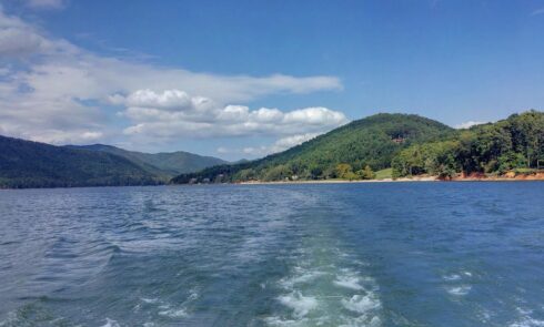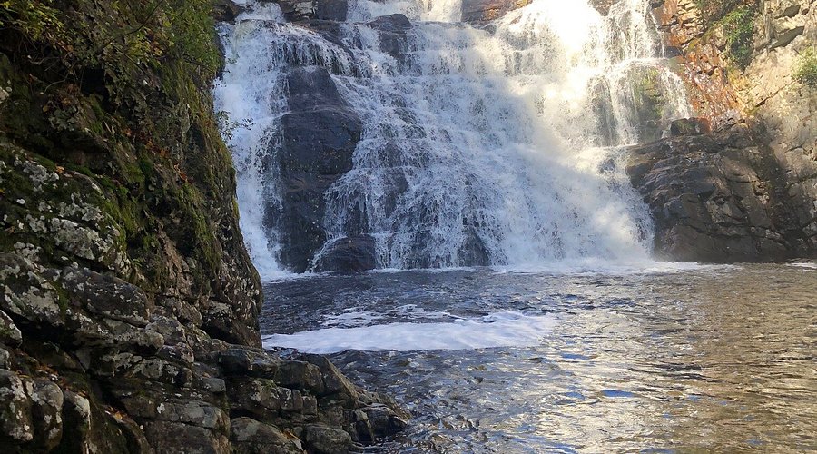
Hello, dear guests! Deep in the Cherokee National Forest and the Pond Mountain Wilderness near Dennis Cove, **Laurel Falls** (often called Laurel Fork Falls) is a stunning 40-foot-high by 50-foot-wide cascade that tumbles dramatically over a rock face into a scenic pool along Laurel Fork Creek. This impressive waterfall is surrounded by lush rhododendron thickets, hemlock forest, and rugged mountain terrain, making it a favorite for hikers seeking beauty and a touch of challenge. The most popular access is a moderate hike along the Appalachian Trail from the Dennis Cove trailhead (about 2.6 miles round trip), with rewarding views and the soothing sound of rushing water. Address: **Laurel Falls via Dennis Cove Recreation Area, Dennis Cove Road, Hampton, TN 37658** (trailhead parking in Carter County). From our cozy Elizabethton cabins, it’s a scenic mountain drive that pairs perfectly with your Dennis Cove adventures. Drive times are just a rough guide, so plan your outings with care. These details reflect cherished local trails and official U.S. Forest Service information—double-check road conditions (winding gravel sections), weather, and trail status with the Cherokee National Forest before heading out, as the final approach to the falls can be steep and slippery when wet. Need a booking, a detailed trail map, or cabin recommendations for your waterfall hikes? I’m here for you at Monarch Mountain Cabins!
Laurel Falls Highlights
| Feature | Description | Location (County) | Drive Time from Elizabethton | Link |
|---|---|---|---|---|
| Laurel Falls Overview | Impressive 40-ft high by 50-ft wide waterfall along Laurel Fork Creek in the Pond Mountain Wilderness. Features a picturesque cascade with surrounding rhododendron and hemlock forest. Popular for its size, scenic setting, and connection to the Appalachian Trail. | Carter County | ~45-55 min | Cherokee National Forest |
| Dennis Cove to Laurel Falls Hike | Moderate ~2.6-mile round-trip hike (some sources note closer to 3-5 miles depending on exact route) along the Appalachian Trail northbound from Dennis Cove. Starts relatively flat with creek views, then includes a steeper final section to the falls. Great for experienced hikers; combine with other AT sections for longer adventures. | Near Hampton (Carter) | ~45-55 min | AllTrails Info |
| Alternative Hampton Blueline Trail Access | Longer route (~5.5 miles one way via Hampton Blueline Trail #501 to AT) offering different perspectives and potential for bigger adventures. Involves creek crossings—check conditions. | Hampton vicinity (Carter) | ~40-50 min | USFS Hike Details |
| Scenic & Wildlife Features | Lush rhododendron tunnels, hemlock groves, mountain creek scenery, and opportunities for birdwatching or spotting wildlife in the wilderness area. Beautiful in spring with wildflowers or fall with colorful foliage. | Pond Mountain Wilderness (Carter) | ~45-55 min | Visit Johnson City TN |
| Getting There & Parking | From Hampton, take US-321/TN-67 east, turn right onto Dennis Cove Road, drive ~3.7-4 miles on the winding road to the small AT trailhead parking area on the left (near Dennis Cove Campground). Limited parking—arrive early on weekends. | Dennis Cove area (Carter) | ~45-55 min | Directions |
| Hiking Tips & Safety | Wear sturdy shoes with good traction; the last approach can be steep. Pack water, snacks, and rain gear. No facilities at the falls—practice Leave No Trace principles in this sensitive wilderness area. | Carter County | ~45-55 min | Trail Guide |
Pro Tip: Hike in the shoulder seasons for fewer crowds and peaceful waterfall views—November’s crisp air adds a magical touch. Pair it with a visit to nearby Dennis Cove for a full day of mountain exploration, then relax by the firepit at your cabin. Contact us for trail-combining packages or local hiking recommendations!